
Tuesday, June 27, 2006
The tracking USB stick
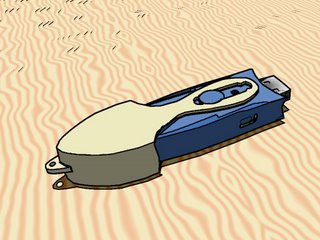 Track Stick is a small USB stick USB that holds in the pocket. Keep it with you all the time and it will record places, time, dates, speeds, directions and altitudes at regular frequency. With more than 1 Mb of memory, it can record several months of your life.
Track Stick receives the signals of 24 satellites. With this information, it can precisely compute its position (and then yours) everywhere on the planet with an accuracy of 15 meters. It can also calculate how long you stay inside, i.e. when it does not receive any GPS signal.
You didn't need it? TrackStick dit it, and now you want it :/
Moreover, the history can be exported to these formats…
- RTF
- HTML : (really) beautiful pages with graphics and google maps
- CSV : columns separated with a comma, can be exported to Excel
- and overall KML, the file's format of Google Earth !
Indeed, its integration within Google Earth allows to generate an animation which draws your road in 3 dimensions. What a sumptuous promise.
Labels: gadgets
archives >> April - March - February - January -December - November - October - September - August - July - June - May
Powered by Stuff-a-Blog
une page au hasard
![]()